![podaris_logo_png.png]](https://support.podaris.com/hs-fs/hubfs/podaris_logo_png.png?height=50&name=podaris_logo_png.png)
While Podaris now offers a powerful, native in-browser Street Editor [link keystone article] that lets you draw, modify, and branch street networks directly in your browser, importing external OpenStreetMap (OSM) data is still fully supported.
This guide describes when and how to import external OSM datasets, including base network and change files, to accommodate advanced workflows
How to Import Your External Network
You can import your network files at two different stages of your project lifecycle:
A. During Project Creation or B. Post-Creation via Project Settings
A. During Project Creation
Step 1:
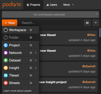
To set up your new street network in Podaris, in the homepage of Podaris select the New dropdown and select Streets.
Step 2:
When you do this you'll be prompted to set the privacy and location settings of the street network, before getting through to the Street Network Settings.
Next, go to the Setup Streets tab and add your PBF file as the Network and your osmChange file as the Change File.
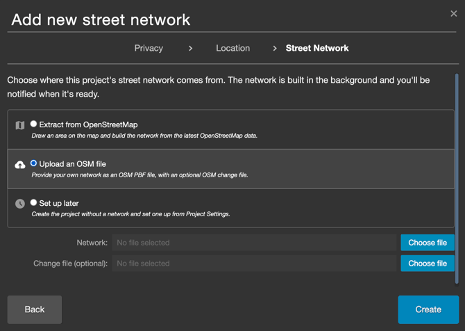
Then click Create to save your changes.
To source the PBF file, you have a few options:
- Use a QGIS plug-in
- Source from the OSM website
- Source from the Geofabrik website - this can be used when you're happy to use a pre-cut region (although sometimes these files can exceed the maximum file size)
You need to download this as an .osm.pbf file ready for use in Podaris.
When you have sourced both the PBF and the osmChange file, you can create a new street network in Podaris.
Step 3:
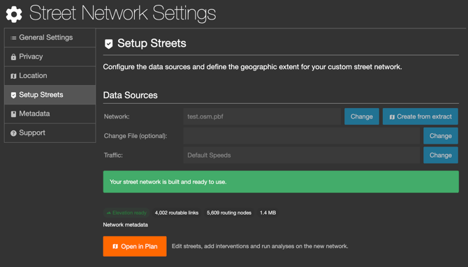
You will be prompted to the Street Network Settings page where you can configure your data sources and define the geographic extent for your street network. Once it's ready, you can open your custom street network in Podaris:Plan.