![podaris_logo_png.png]](https://support.podaris.com/hs-fs/hubfs/podaris_logo_png.png?height=50&name=podaris_logo_png.png)
After selecting the agencies and dates to import, you can filter your import by geography.
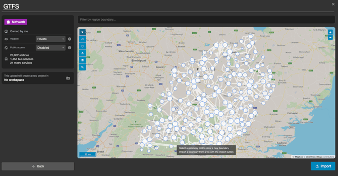
Why Filter by Geography? Large transport networks (such as regional or national GTFS feeds) often contain tens of thousands of routes, stops, and schedules outside your project's scope. Filtering by geography keeps your workspace clean, reduces memory usage, and improves performance by bringing in only the features relevant to your study area.
Connected Services: By limiting the import to relevant areas, you can significantly reduce processing time and data complexity, making your analysis more efficient and focused. Additionally, for projects that involve modifying or extending existing transit services in a specific locale, filtering allows you to isolate the relevant portion of the network for easier manipulation and analysis. However, be careful not to exclude geographies with connected services which you may want to include in future accessibility analysis.
How it Works in the Asset Library: Spatial filtering is built directly into the map preview panel within the asset library whenever you import or upload a network or dataset.
- Importing Everything: Leaving the map boundary blank brings in all available features.
- Applying a Boundary: Use the toolbar above the map preview to draw a polygon or circle, import a GIS boundary file, or search for a named administrative area (such as a local authority).
For step-by-step instructions on using the map drawing tools and administrative boundary search in the asset library, see Adding Sources with the Asset Library.
See also: GTFS Data Import Pipeline