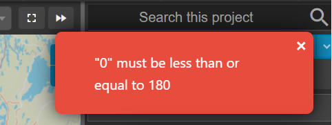
Currently, Podaris supports the WGS84 Coordinate Reference System (CRS). Attempting to import a GeoJSON dataset with a CRS other than WSG84 will produce an "0" must be less than or equal to 180 error.
A number of tools exist for identifying the CRS of a dataset when it is unknown, and transforming its data into a new CRS.
- MyGeodata Convertor - an online tool for identifying a dataset's CRS and converting it.
- A guide to saving a dataset in another CRS with the free, open source and cross-platform GIS tool QGIS.