
N.B. This feature is only available in Podaris: Plan and Streets Projects modes.
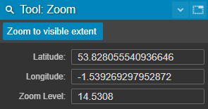
The Zoom panel displays the current latitude and longitude of the visible area. These values are editable, allowing you to quickly move to any location.
The value is shown as a decimal number (rounded to four decimal places).
The available zoom range depends on the basemap in use, so the maximum zoom level may vary.
Clicking the Zoom to visible extent button will automatically zoom to a level where all of your project's geometry is visible.