Alongside other project types such as Networks, Datasets and Tilesets, Podaris features a project type called Streets, designed to store a collection of street networks.
In this tutorial, we are going to look at how to use the third-party application JOSM, an editor for OpenStreetMap (OSM) in order to edit and export OSM street data for use in Podaris.
Step 1 - Download JOSM
Java OpenStreetMap Editor (JOSM) is a cross-platform Java application that "supports loading GPX tracks, background imagery, and OSM data from local sources as well as from online sources and allows you to edit the OSM data (nodes, ways, and relations) and their metadata tags."
Download and run josm.jnlp from https://josm.openstreetmap.de
Step 2 - Download OSM data
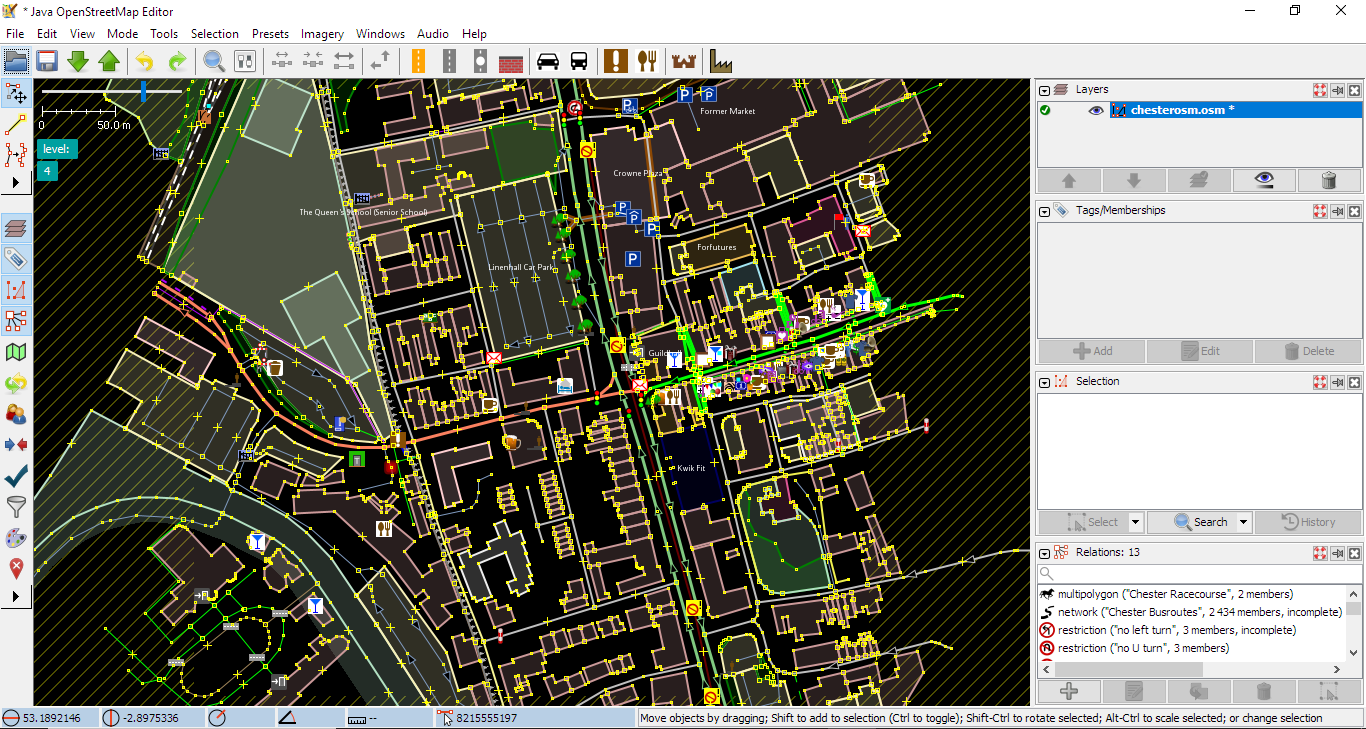
The  button in JOSM will allow you to select and download OSM data for a particular region. There are a number of ways to do this within the application.
By default, you are presented with a slippy map that will allow you to left click and drag to select a region and  to open that region in the editor.
Step 3 - Add PBF Plugin
In order to use OSM data from JOSM in Podaris, you will need to be able to export it to the OBS.PBF file type. The easiest way to do this is to enable the PBF plugin in JOSM.
Select Edit > Preferences (or click F12). Then select Plugins from the sidebar. Click download list then search for pbf. Select it with the checkbox and click Okay to install the plugin.
Step 4 - Edit OSM street data in JOSM
JOSM provides extensive capabilities for editing OSM data that are beyond the scope of this tutorial. JSOM's in-app help which can be accessed by pressing F1.
Here are a few others resources to help acquaint you with the tool:
- The Getting Started page on the JOSM website provides a comprehensive introduction.
- Learn OSM hosts a comprehensive guide to detailed editing with JOSM.
- This time-stamped YouTube tutorial offers a good video primer on the JOSM interface.
The section on adding tags to ways or nodes allows you to add tags that tell the Podaris routing engine whether a way or node is accessible or not. Some common use cases and their OSM tags for routing (ways) are:
|
Tag |
Use Case |
| motor_vehicle=no | Closes a road to cars |
| highway=cycleway | Permits only cycle routings |
| highway=bus_guideway | Permits only bus routing |
| maxspeed=* | Max speed of way in KM |
Step 5 - Export from JOSM
Once you have made your changes in JOSM, click File > Save As... making sure to change the file type to OSM Server Files PBF Compressed (*.osm.pbf)
Step 6 - Import into Podaris
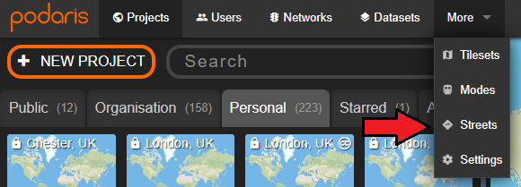
On the Podaris home screen, click More > Streets to select Streets.
Now click ![]() to create a new streets network. You will be required to select privacy settings and the location of the streets network.
to create a new streets network. You will be required to select privacy settings and the location of the streets network.
Step 7 - Set your network data source
Click the Change button next to Network and select the OSM.PBF file that you have exported from JOSM. The street network will now be available to use in a Podaris project for your isochrones, bus route planning, and as part of multi-modal journey planning for your simulations.