The join attributes feature enables users to join a file to an existing data layer based on a shared attribute, meaning information across different datasets can be easily combined in Podaris
Why might I want to join datasets?
It is common when working with datasets to find that the geometries and attributes relating to a particular dataset are provided separately. A typical example might be a shapefile of 2021 Census Output Areas, and a separate csv file containing information about population numbers and density in each of the Outputs Areas.
In instances like these it is useful to be able to join data together, so that information across different datasets can be combined based on shared attributes.
What is the join attributes feature?
The ‘join attributes’ feature makes joining datasets possible by enabling users to join a file to an existing layer based on a shared attribute. To read more about how to import dataset layers in Podaris, see here.
How do I join data by attributes in Podaris?
Step by Step
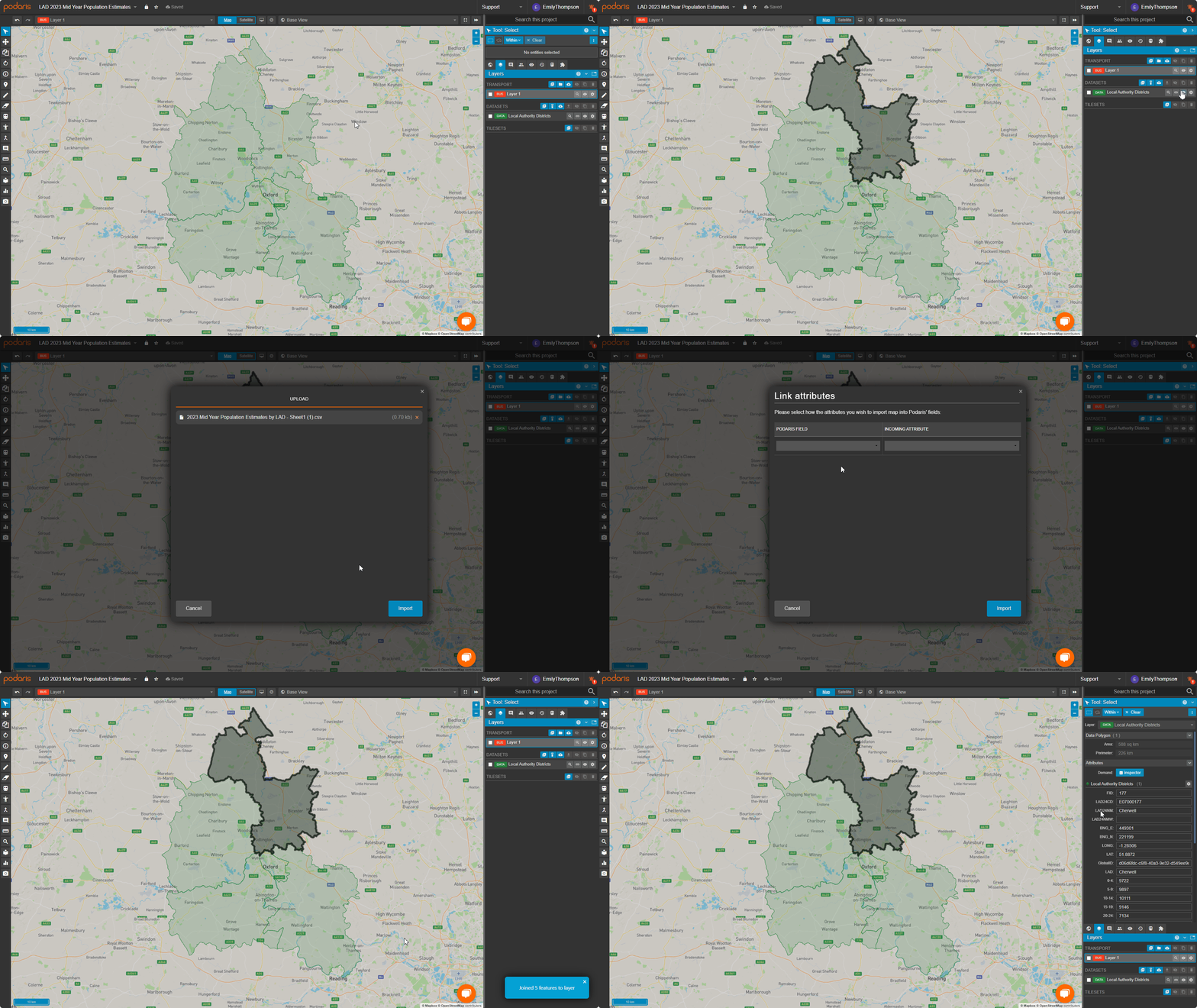
- Locate the dataset you want to join data to in the datasets layer
- Click the join attributes button
next to this data layer
- Import the file you wish to join to this data layer

- Select the attributes you want to include and for each attribute set the attribute type to either String, Number or Boolean

- Select the attribute you wish to join the two datasets on (ie. the attribute in the existing dataset that matches the attribute in the new dataset) and click import

- The attributes in the new dataset will now be joined to the existing dataset. You can view them using the select tool - by selecting a point in your dataset on the map all attributes for that point will be displayed in the tool properties panel

An example of these steps being carried out to join Local Authority District (LAD) population estimates in csv form to their respective LAD in Podaris is shown below.

