The Station tool lets you place stations on the active layer, which act as origin and destinations within your transport network.
The station properties will be determined by its LayerType.
Tip: Stations can be quickly renamed by selecting a station and pressing SHIFT+R
Connected Network
Stations must be connected to a transport network in order to be considered in the Station matrix and isochrone calculations. Stations are considered connected if they are part of a route, or have fixed infrastructure connected to them.
To calculate station-to-station travel times to be calculated, the stations must be connected to the network. In Podaris:Plan, disconnected stations are shown with a warning label. This is not visible in Podaris:Engage.
For mass transit systems such as metros, these should generally be as inline stations; for personal transport systems such as PRT, stations should be offline.
| Disconnected station | Connected in-line station | Connected off-line station |
|---|---|---|
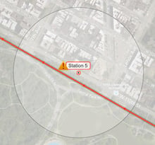
|
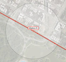
|
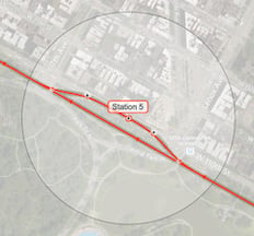
|
Importing Stations
The ![]() button on the Stations tool panel allows you to import stations into your project or network in one of two ways:
button on the Stations tool panel allows you to import stations into your project or network in one of two ways:
- From any existing Podaris for which you have appropriate permissions.
- Either all stations from an existing project or network, or only those within the current map viewport.
- Import NAPTAN XML file. NAPTAN (or National Public Transport Access Nodes) files contain location data for transport access points across a variety of modes (bus, rail, tram, etc...)
- Either all stations from a NAPTAN XML file, or only those within the current map viewport.
Station Options
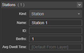
| Kind | Station, depot of waypoint. See specific notes on waypoints. |
| Name | A unique descriptor for your station. |
| ID | Station ID - this must be unique. |
| Berths | Number of berths |
| Avg Dwell Time | By default, this is inherited from the transport layer, although it may be overridden on a per-station basis here. |
Grouped Stations
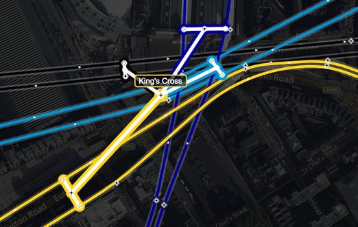
Complex stations with multiple platforms, or which serve multiple routes, can be created by grouping stations together. This allows each station to be treated as a platform within the larger parent station. Only the parent station will be treated as a destination in the Station Matrix.
To group stations together, use the Select tool to select everything you want to group, then look at the Tool Properties panel, look under the Stations heading, and press the Group button. A new parent station will appear, linking together the platforms on each line. The parent station will be positioned in the weighted center of its child stations, unless it is manually repositioned. (It can then be recentered by selecting it and clicking position automatically).
To ungroup stations, select the parent station and click Ungroup. This will make all child stations independent again. Selecting an individual child station and clicking Ungroup will pull it out of the master group, without otherwise breaking up the group.
Note that parent stations can be grouped together, creating a hierarchy of station platforms.
Scheduled Services at a Stop Level
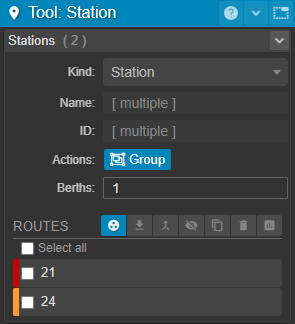
If your project includes routes created as part of a scheduled service you can use the Select Tool to select one or more stations and Podaris will show you the visible routes which call at those stations in the active tool panel:
You can find more about filtering these routes to understand which serve a stop or station and answer questions about service frequency by day or time of day, on this dedicated page.
Rendering Style
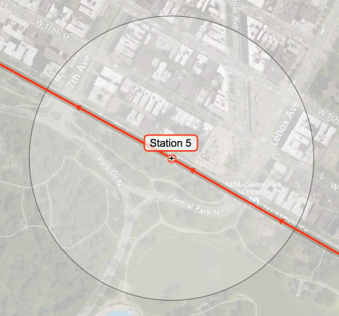
By default, stations are rendered with three elements:
- A Dot, showing the location of the station
- A Label, showing the name of the station
- An Accessibility radius, showing a user-defined catchment around the station.
These can be hidden or have their style changed by adjusting the Display Settings.
Waypoint Creation
Waypoints are created with the station tool, however, unlike stations, they do not cause vehicles to slow down and stop, and dwell times specified in your layer's transport layer properties will not be applied.
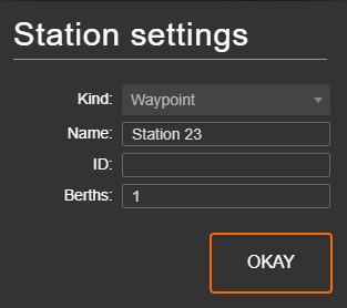
Waypoints can also be created during the pattern drawing and editing process, by clicking the ![]() next to the station that you wish to turn into a waypoint.
next to the station that you wish to turn into a waypoint.
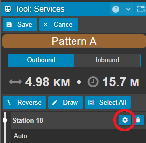
From here, select waypoint as your station kind and click OKAY.
Deleting Stations
If you want to completely delete a station, waypoint or depot this can be easily done using the delete button on your keyboard. Simply click on the station you want to remove, and once selected press the delete button on your keyboard.
If you want to remove a station (or waypoint, or depot) from a route, but not delete it entirely from the project map, this can be done from within the pattern editor of your route.
For the route and route pattern you want to remove the station from, click the pencil icon to enter pattern editing mode

Then identify the station you want to remove from the pattern in the station list, and click the delete button next to this station

Your changes will be automatically saved. Now exit pattern editing mode using the Stop Editing button in the top right hand corner of your screen


